

|
Shvilist is an excellent source for up-to-date
information on the Israel National Trail |
Weather

It's always a good idea to check the weather before heading out. An excellent source is the Israel Meteorological Society Weather Forecast in English, Updated twice a day
Navigation
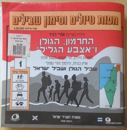
I like to hike with both physical and digital trail maps. Unlike your iPhone, those big old 1:50000 laminated maps produced by SPNI don't run out of batteries and still work even after you drop them in the water. These were the original maps used on the trails and they are still the ones most commonly seen today. There are 20 maps in the series that cover every single kilometer of the country. I've purchased the full set and use it all the time. The drawback of course is that if you own older editions they won't how the newer roads and trails that have been created since publication. Individual maps cost 89 NIS each and the entire set is 1,490 NIS.
|
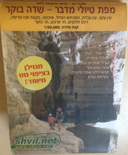
ShvilNet also provides an excellent selection of maps for the popular hiking and biking areas of Israel. However they do not have a series that covers the entire country.
Pre-trip I use the website OpenStreetMap as a resource for previewing trips that I am planning. The site has tools to select the segments of exisiting, established trails that you want to hike and it provides you with an elevation and distance chart for the segments selected. The drawback is that they use a map set that does not always have all the trails on it. |
|
Before hitting the trail, I also use Wikiloc as an excellent source to see if someone else has already uploaded the hike that I want to try. Once I am on the hike I also use it to track and to upload trails that I am walking. It's free, and very simple to use but does not have an overlay of exisiting marked trails that one would see on ShvilNet or Trailze.
Digital Navigation on the Trail
While the physical maps are great at showing you the trails, they won't show you exactly where you are on those trails. That's when having a GPS system in conjunction with a good overlay map is a huge advantage.
Trailze is a free app for navigating the hiking trails and bike paths of Israel. I first saw it in the fall of 2015 and I'm really impressed. It shows you your location realtive to the trails. Really good to use when you think that you may have made a wrong turn along the way.
The Cadillac of digital navigation for Israel is the combination of ShvilNet digital maps with the GPS program TwoNav. ShvilNet updates their digital maps and it is these that are loaded as the mapset for the TwoNav system which is a sophisticated navigation program for both navigating and recording your trails. The price of the TwoNav Premium is 21 NIS and the mapset bundled with it from ShvilNet is another 470 NIS.